Tulotoma magnifica is a federally threatened freshwater gastropod endemic to the Mobile Basin in Alabama. It was considered extirpated from the Alabama River until its rediscovery there in 2006. Tulotoma occurs primarily in colonies in large interstitial spaces beneath boulders and in bedrock crevices. We used side-scan sonar to identify boulder habitat in the Alabama River and to focus dive surveys at those sites. Eighty-five sites with potential Tulotoma habitat were identified with sonar and assessed by a diver. Colonies were found at five locations, three of which were previously unknown. Side-scan sonar greatly increased efficiency during this survey and was a useful tool.
INTRODUCTION
Tulotoma magnifica (Tulotoma) (Conrad, 1834) comprises a monotypic genus within the Viviparidae and is endemic to the Mobile Basin of Alabama. It was considered extinct until its rediscovery in 1988 (Hershler et al. 1990). Tulotoma was listed as endangered under the U.S. Endangered Species Act in 1991 but was reclassified as threatened in 2011 based on improvements in a large Coosa River (Jordan Dam tailwater) population and discovery of several smaller, previously unknown populations (USFWS 2011). The snail is relatively large, up to 50 mm in height, and has a distinctive, moderately heavy shell usually adorned with variable, spirally arranged nodules. Similar to other viviparids, Tulotoma is ovoviviparous, retaining eggs in a chamber of the mantle cavity until they hatch (Johnson 2004; Johnson et al. 2013). Tulotoma is generally found in colonies under large rocks or in bedrock crevices in flowing water of large streams. Suitable habitat usually has a bottom roughness value greater than 2 (on a scale of 0-5), boulder density greater than 2/m2, rocks of dissimilar sizes, and current velocity sufficient to prevent silt accumulation (Christman et al. 1997). In tributaries of the Coosa River, Tulotoma consistently used larger and taller rocks, but water depth, current speed, and abundance of co-occurring gastropod species were not significantly related to Tulotoma occurrence (DeVries et al. 2003).
The type locality for T. magnifica is the Alabama River at Claiborne, Monroe Co., Alabama, but Tulotoma is reported historically from only one other Alabama River site (Hershler et al. 1990). It formerly was considered restricted to the main channels of the Coosa and Alabama rivers and it was thought that impoundment and channelization of these rivers in the 20th century drove the species to extinction (Stein 1976). However, populations were discovered subsequently in the lower, unimpounded reaches of some larger Coosa River tributaries, as well as in a short free-flowing reach of the Coosa River downstream of Jordan Dam (Hershler et al. 1990). A small Tulotoma population was discovered in 2006 in the Alabama River downstream of Claiborne Dam, near the type locality, and a larger population was discovered in 2008 near Selma (J. T. Gamer, unpublished data). Another small population was discovered in 2008 downstream of Millers Ferry Dam (J. Powell, US Fish and Wildlife Service, personal communication).
The Alabama and Coosa rivers flow through different physiographic provinces and provide different stream habitats. The middle and lower reaches of the Coosa River where Tulotoma was widespread historically flow through the Valley and Ridge and Piedmont physiographic provinces to the Fall Line. Streams in these regions have relatively high gradients with frequent bedrock and boulder substrates. Just downstream of the Fall Line, the Coosa and Tallapoosa rivers join to form the Alabama River, which flows across the East Gulf Coastal Plain physiographic province. Streams in the Coastal Plain have lower gradients and substrates of unconsolidated and finer sediments with only localized outcroppings of bedrock and associated cobble and boulders.
We conducted a comprehensive survey of the Alabama River in 2010 to better understand the current distribution of Tulotoma. We used side-scan sonar to locate suitable boulder habitat and sampled these habitats by diving. Our study appears to be the first to use this technique for detecting a specific freshwater snail species.
METHODS
The study section included 388 km of the Alabama River, extending from Alabama River km (ARK) 38 upstream to the river’s origin at the confluence of the Coosa and Tallapoosa rivers (ARK 491, Figure 1). Within this section, we conducted surveys only in riverine reaches downstream of Robert F. Henry, Millers Ferry, and Claiborne dams, as well as the area downstream of the confluence of the Coosa and Tallapoosa rivers. Areas of slack water and extensive sediment deposition immediately upstream of dams were assumed to provide unsuitable habitat for Tulotoma and were not surveyed. These areas generally have interstitial spaces underneath boulders filled with sediment, leaving no space for Tulotoma. The lower 38 km section of the Alabama River is considered outside of the historical range of Tulotoma and previous surveys indicated this section has little boulder habitat (J. T. Gamer, unpublished data).
This study was carried out from 5 August through 3 November 2010. We systematically surveyed the study section with a Humminbird 1197c side-scan sonar unit (Johnson Outdoors Marine Electronics, Inc., Eufaula, AL) mounted on a flat-bottomed jon boat. The sonar unit was set to scan 60 m on each side of the boat resulting in a total coverage of 120 m perpendicular to the path of the boat. We made a single pass through each reach by steering a downstream course about 45 m from and parallel to the river bank at an average speed of 8.8 km/h (range: 7–10 km/h). The river is wider than 120 m throughout its length, and time did not allow multiple passes necessary to cover the entire river bottom. However, based on our prior experience on the river (20 years, including 191 h of diving bottom time, J. T. Gamer), exposed boulders occur primarily on the outer bank of river bends or other areas where bank scour occurs. We focused our surveys on these areas and did not survey the inner bank or other depositional areas. In straight river reaches, we chose a course based on bank features (e.g., rocks, bluff banks) that suggested the presence of suitable habitat, again based on previous experience. Areas of potential habitat located by sonar were marked with flagging tape on the adjacent bank or an anchored buoy. The sonar boat relayed to a separate dive boat specific site information such as water depth, distance from the bank, habitat area, and irregular bottom features.
Figure 1.
Map of the Alabama River showing location of potentially suitable habitat for Tulotoma identified by side-scan sonar. Closed circles indicate sites where Tulotoma was found by divers, and open circles indicate sites with apparently suitable habitat but where Tulotoma was not found. Red reaches are those that were not surveyed, and dams are represented as solid black lines (A — Robert F. Henry Dam, B — Millers Ferry Dam, C — Claiborne Dam). Inset map shows the location of the Alabama River in Alabama. Note that a portion of the Tombigbee River lies within the study area box, but it was not surveyed.

All sites having boulder substrate identified by sonar (Figure 2) were examined by a diver working from an anchored boat equipped with surface-supplied air. All dives were performed by J.T. Gamer, and searches were visual or by touch, depending on visibility, with emphasis on areas underneath boulders. Searches were carried out within the radius of the 30 m air line connecting the diver to the boat. Dive duration was not standardized and depended on the amount of suitable habitat present and physical characteristics of the site. For example, at some sites boulders were embedded in the sediment and provided no interstitial spaces for Tulotoma, which shortened dive times.
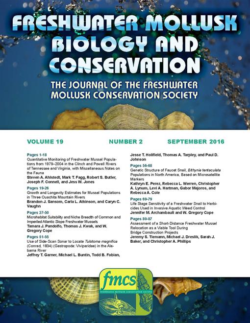
Figure 2.
Side-scan sonar screen view of Alabama River substrate. The left side of the image shows boulder habitat along the channel slope potentially suitable for Tulotoma. The dark vertical column in the center of the image represents the water column. The right side of the image shows unstable sand substrate where Tulotoma are unlikely to be present.

Dives were terminated when the diver had searched all suitable habitat within the 30 m radius, when it became evident that habitat was unsuitable, or when Tulotoma was encountered. If Tulotoma was encountered we made a brief assessment of the relative size and age structure of the population but terminated the dive shortly thereafter to limit habitat disturbance and potential mortality. The diver collected all snails encountered during a dive and placed them in a mesh bag, with the exception of Elimia spp. and Pleurocera prasinata, which were too numerous to collect at some sites but were easily distinguished from Tulotoma even with little or no visibility. Snails were brought to the surface for identification and all Tulotoma were measured, photographed, and released. Vouchers of all improtected taxa were retained.
To determine if efficiency was increased by using sonar, we recorded effort expended by the sonar study (as persondays) and compared this with the estimated effort necessary to carry out the survey without sonar. For this estimation, sites potentially having suitable boulder substrate were identified from Alabama River aerial photographs based on our previous experience on the river. Likely sites included river bends and straight reaches of at least two kilometers. Without the benefit of sonar, we assumed that an average of four dives/site (using a two-person crew) would be necessary to detect Tulotoma, and five dives/day could be completed (the average number completed during the sonar study). As such, the total number of person-days required for surveying the study section without sonar was estimated as (number of likely sites × 4 × 2)/5. Total effort for the sonar method included effort of the sonar team and the dive team.
Table 1.
Alabama River localities with apparent suitable Tulotoma habitat.

RESULTS
Eighty-five Alabama River sites with boulder habitat were identified using side-scan sonar and assessed for the presence of Tulotoma by the diver. Overall, dives averaged 30 min in duration, with a range of 11–93 min, depending primarily on habitat suitability and whether and how quickly Tulotoma was encountered. Dives at sites that provided little Tulotoma habitat (N = 58) averaged 27 min in duration, dives in apparent good habitat, but during which no Tulotoma was encountered (N = 19) averaged 41 min in duration. Because dives were halted soon after Tulotoma was found, dives at those sites (N = 5) were also of relatively short duration, averaging 29 min.
Tulotoma was found at five sites (Table 1) irregularly distributed in the upstream half of the study reach (Figure 1). These sites included the river reach adjacent to Selma (ARK 330.1), where Tulotoma was found previously. The Selma site appeared to support the largest population of all five sites. Tulotoma was locally abundant (some boulders harboring over 100 individuals). One of the other sites, ARK 372.6, was near another previously known occurrence (ARK 372.9, found September 2008). Previously unknown populations were discovered at ARK 433.2 (near the mouth of Pintlala Creek, Robert F. Henry Dam pool), ARK 348.7 (Cunningham Bluff, Millers Ferry Dam pool), and ARK 318.6 (Millers Ferry Dam pool, upstream of the mouth of Cahaba River). The number of Tulotoma encountered varied at the other sites, but only a single individual was encountered at ARK 348.7. All sites except ARK 348.7 harbored a wide range of size classes from juveniles to adults.
Our sonar survey required a total of 64 person-days to perform, including both the sonar and dive teams. Both teams required two workers each, the dive team with a diver and tender and the sonar team with a boat driver and sonar operator. A total of 14 d (28 person-days) was required to complete the sonar survey (average = 25 km of river surveyed/ day), and 18 d (36 person-days) were needed by the dive team to examine all potential sites identified by the sonar team (average = five dives/day). We estimated that the total effort required to survey the same river section without sonar was 280 person-days. This estimate included 175 sites identified from aerial photographs as potentially providing suitable habitat.
DISCUSSION
Tulotoma has long been known to occur almost exclusively under large rocks and in bedrock crevices. Side-scan sonar proved a valuable tool for locating boulder habitat and greatly improved sampling efficiency. We were able to complete our survey in about 20% of the time we estimated would be required to survey the same river section without the use of sonar. Previous scientific uses of side-scan sonar in freshwater lakes and rivers include habitat assessments, sediment studies, and surveys of fish, unionids, and Zebra Mussels (Duncan and Kubecka 1996; Haltuch and Berkman 2000; Woodruff et al. 2001; Kaeser and Litts 2008, 2010; Gonzalez-Socoloske et al. 2009; Powell et al. 2015). We found no previous studies that used sonar for a survey of a freshwater gastropod.
Our observations provided additional detail about the habitat preference of Tulotoma. Tulotoma occurred exclusively under boulders composed of dense, hard rock and never under brittle siltstone; siltstone boulders were common at some sites and often fell apart when overturned. The amount of interstitial space and sediment underneath the boulders also appeared to be important factors for the occurrence of Tulotoma. Boulders that were embedded or had interstitial spaces choked with sediment (generally sand) held no Tulotoma. Boulders lying on bedrock or over other boulders often had larger interstitial spaces than those lying on gravel or sand, but these large spaces were sometimes kept free of silt by currents. No Tulotoma were found in these habitats, suggesting that at least some silt is necessary for colonization by the species.
Tulotoma was not encountered at 80 of the sites assessed. However, habitat at some of these sites appeared suitable, and most were in upper reaches of Millers Ferry Dam pool, which harbors four of the seven known Tulotoma populations in the Alabama River. It is possible that small populations of Tulotoma exist at some of these sites, but their detection would require more dive time than could be expended at any one site in this study.
Tulotoma was not encountered during this survey at two sites where it was found previously. In 2006, a small colony of Tulotoma was found in Claiborne Dam tailwaters at ARK 113.5 (J. T. Gamer, unpublished data). At that time, only seven individuals were observed, ranging in size from 4 to 22 mm in shell height, during a total of 7 h, 35 min bottom time over 3 d. In 2008, six individuals were encountered in the upper reaches of Claiborne Dam Pool (J. R. Powell, personal communication). Again, detecting these small populations would require considerable dive time, which was not feasible in our study because of the large number of sites we surveyed.
We discovered three previously unknown populations of Tulotoma in the Alabama River and confirmed the persistence of two previously known populations. The population we found at ARK 372.6 probably is contiguous with a population previously found at ARK 372.9. At least one of these populations (ARK 330.1) appears to be large, but we were unable to conduct thorough population assessments at any site. However, evidence of recent recruitment was evident at all but one site. These findings support the recent downlisting of this species from endangered to threatened (USFWS 2011). More focused surveys of known populations or other potentially suitable sites are needed to assess population size and extent. Side-scan sonar was a valuable tool in our survey and can increase the efficiency of future efforts.
ACKNOWLEDGEMENTS
This survey was conducted using American Recovery and Restoration Act funds from the U.S. Army Corps of Engineers. We thank Wade Taylor and Bill Stark (ADCNR) for field assistance, Paul Hartfield (USFWS) for advice, Jeff Powell (USFWS) for help in securing funds, Adam Kaeser for training with the side-scan sonar, and Charlotte LaGrone and Stacy Norris (ADCNR) for administrative guidance. The editor, Wendell Haag, and two anonymous reviewers greatly improved this manuscript.