BioOne.org will be down briefly for maintenance on 14 May 2025 between 18:00-22:00 Pacific Time US. We apologize for any inconvenience.
Registered users receive a variety of benefits including the ability to customize email alerts, create favorite journals list, and save searches.
Please note that a BioOne web account does not automatically grant access to full-text content. An institutional or society member subscription is required to view non-Open Access content.
Contact helpdesk@bioone.org with any questions.
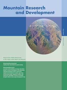
The Upper Indus Basin (UIB) covers an area of more than 200,000 km2 and has an elevation range from below 1000 to over 8000 m above sea level. Its water resources underpin Pakistan's food security and energy supply. Vertical and horizontal variations in key climate variables govern the runoff contributions of the UIB's various elevation zones and subcatchments. Remote sensing climatic data products from NASA's Moderate Resolution Imaging Spectrometer (MODIS) instrument platform provide an opportunity to develop a spatial characterization of the climatology of remote and rugged regions such as the UIB. Specifically, snow-covered area (SCA) and land surface temperature (LST) have been shown to provide good analogues, respectively, for precipitation and air temperature. As such, SCA and LST quantify regional variations in mass and energy inputs to runoff generation processes. Although the 10-year (2000–2010) MODIS observational record is not adequate to evaluate long-term trends, it does provide a consistent depiction of annual cycles and a preliminary assessment of interannual variability. This study presents a summary of the period means and interannual variability found in remotely sensed SCA and LST products for the UIB. It then provides an update of locally observed recent climate trends for the 1962 to 2007 period. Nonparametric trend tests are applied both to the local observations and to remote sensing records to assess patterns in recent variability. The climatic noise (intense variability) of the past decade, however, renders conclusions on nascent trends in SCA and LST premature. Finally, runoff sensitivity to temperature change—spatially applied as summer (JJA) nighttime 0°C LST isotherm migration—is assessed for a range of potential scenarios. Results indicate that changes in mean summer (JJA) runoff could range from −30 to 35% or more, depending on whether recent locally observed changes continue or scenarios derived from current regional climate model (RCM) simulations unfold.
Accurate quantification of the spatial distribution of precipitation in mountain regions is crucial for assessments of water resources and for the understanding of high-altitude hydrology, yet it is one of the largest unknowns due to the lack of high-altitude observations. The Hunza basin in Pakistan contains very large glacier systems, which, given the melt, cannot persist unless precipitation (snow input) is much higher than what is observed at the meteorological stations, mostly located in mountain valleys. Several studies, therefore, suggest strong positive vertical precipitation lapse rates; in the present study, we quantify this lapse rate by using glaciers as a proxy. We assume a neutral mass balance for the glaciers for the period from 2001 to 2003, and we inversely model the precipitation lapse by balancing the total accumulation in the catchment area and the ablation over the glacier area for the 50 largest glacier systems in the Hunza basin in the Karakoram. Our results reveal a vertical precipitation lapse rate that equals 0.21 ± 0.12% m−1, with a maximum precipitation at an elevation of 5500 masl. We showed that the total annual basin precipitation (828 mm) is 260% higher than what is estimated based on interpolated observations (319 mm); this has major consequences for hydrological modeling and water resource assessments in general. Our results were validated by using previously published studies on individual glaciers as well as the water balance of the Hunza basin. The approach is more widely applicable in mountain ranges where precipitation measurements at high altitude are lacking.
Assessment of water resources from remote mountainous catchments plays a crucial role for the development of rural areas in or in the vicinity of mountain ranges. The scarcity of data, however, prevents the application of standard approaches that are based on data-driven models. The Hindu Kush–Karakoram–Himalaya mountain range is a crucial area in terms of water resources, but our understanding of the response of its high-elevation catchments to a changing climate is hindered by lack of hydro-meteorological and cryospheric data. Hydrological modeling is challenging here because internal inconsistencies—such as an underestimation of precipitation input that can be compensated for by an overestimation of meltwater—might be hidden due to the complexity of feedback mechanisms that govern melt and runoff generation in such basins. Data scarcity adds to this difficulty by preventing the application of systematic calibration procedures that would allow identification of the parameter set that could guarantee internal consistency in the simulation of the single hydrological components. In this work, we use simulations from the Hunza River Basin in the Karakoram region obtained with the hydrological model TOPKAPI to quantify the predictive power of discharge and snow-cover data sets, as well as the combination of both. We also show that short-term measurements of meteorological variables such as radiative fluxes, wind speed, relative humidity, and air temperature from glacio-meteorological experiments are crucial for a correct parameterization of surface melt processes. They enable detailed simulations of the energy fluxes governing glacier–atmosphere interaction and the resulting ablation through energy-balance modeling. These simulations are used to derive calibrated parameters for the simplified snow and glacier routines in TOPKAPI. We demonstrate that such parameters are stable in space and time in similar climatic regions, thus reducing the number of parameters requiring calibration.
The high Alpine landscape is significantly shaped by glacial and periglacial processes. It is sensitive to effects caused by global warming, such as glacier retreat and permafrost degradation. Trails and mountain huts form the infrastructure basis for hiking and mountaineering in the Alps. This infrastructure is a decisive factor for summer mountain tourism. This article presents a classification of phenomena describing the effects of global warming on high Alpine trails and routes. The classification was developed based on an in-depth study in the Austrian Alps. The examples collected show that in the context of global warming, numerous different types of phenomena can affect both the occurrence of natural hazards along high Alpine trails and routes, and the accessibility of the terrain. Depending on the specific situation, threats and difficulties can increase or decrease. Trail holders have to adapt the high Alpine trail network to these changes. The classification presented here can serve to support maintenance of the Alpine trail network in the future.
This article deals with the development of irrigated agriculture in the Upper Indus Basin of Central Ladakh in Northern India. Artificial irrigation, fed by meltwater from glaciers and snow cover, forms the backbone of regional food production in this semiarid Trans-Himalayan environment. Following an integrated socio-hydrological approach, we present 2 local case studies on the village level and an overview of Central Ladakh based on multi-temporal remote sensing analyses, qualitative interviews, and regional background information. The remote sensing analyses reveal both persistence and change of land use structures over the past 4 decades. In order to understand the characteristics and variations of this land use system, the role and influence of different stakeholders are analyzed. We show how land use dynamics reflect the interplay of local practices and external interventions in mountain development.
Mountain springs emanating naturally from unconfined aquifers are the primary source of water for rural households in the Himalayan region. Due to the impacts of climate change on precipitation patterns such as rise in rainfall intensity, reduction in its temporal spread, and a marked decline in winter rain, coupled with other anthropogenic causes, the problem of dying springs is being increasingly felt across this region. This study was taken up in the Sikkim Himalaya, which has received limited attention despite being a part of the Eastern Himalaya global biodiversity hot spot. The objective of this study was to understand the basic characteristics of the springs and to demonstrate methods for reviving them. We found the rural landscape dotted by a network of microsprings occurring largely in farmers' fields, with an average dependency of 27 (±30) households per spring. The spring discharge generally showed an annual periodic rhythm suggesting a strong response to rainfall. The mean discharge of the springs was found to peak at 51 L/min during the postmonsoon months (September–November) and then diminish to 8 L/min during spring (March–May). The lean period (March–May) discharge is perceived to have declined by nearly 50% in drought-prone areas and by 35% in other areas over the last decade. The springshed development approach to revive 5 springs using rainwater harvesting and geohydrology techniques showed encouraging results, with the lean period discharge increasing substantially from 4.4 to 14.4 L/min in 2010–2011. The major challenges faced in springshed development were the following: identifying recharge areas accurately, developing local capacity, incentivizing rainwater harvesting in farmers' fields, and sourcing public financing. We recommend further action research studies to revive springs to advance the outcomes of this pilot study and mainstreaming of springshed development in watershed development, rural water supply, and climate change adaptation programs, especially in the Himalayan region.
A simple environmental vulnerability assessment scheme is developed and illustrated using several streams in Azerbaijan as examples. Vulnerability of a river ecosystem is defined in terms of a combined impact of pressure factors such as water withdrawals, pollution, climate change impact on flow variability, and land use. These factors are used to measure the sensitivity of various elements/components of the system to impacts. The choice of these indicators may vary from area to area and depends on the nature of man-made and natural conditions. Each factor is characterized and quantified using a specific indicator and score. The total vulnerability score is estimated as a sum of the scores of all indicators. Most of the streams studied in Azerbaijan were found to be very vulnerable or extremely vulnerable, according to the developed scheme. The overall approach is straightforward and transparent. Conclusions are made about the vulnerability and/or resiliency of streams, to be taken into consideration when planning for water-sources development for the future.
KEYWORDS: Solar energy, carbon effect, vegetation effect, nitrogen effect, reduction of carbon emissions, reduction of deforestation, reduction of nitrogen loss, Tibet, China
Due to the high altitude of over 4000 m, scattered inhabitation, and prevalent pastoral system, Tibet (Xizang Autonomous Region) is regarded as a unique geographic zone, possessing the most abundant solar energy resources in China. Due to the extensive use of conventional energy, significant ecological problems, including deforestation, soil erosion, land degradation, and desertification, have emerged and are becoming more severe; it is proposed that these issues can be mitigated by the utilization of solar energy. Consequently, studying the ecological effects of solar energy development in Tibet is of substantial significance. Accordingly, the resources, current situation, and potential of solar energy in Tibet were examined, and a framework for analysis to support appraisal of ecological effects was formulated. On the basis of this framework, the carbon effect, vegetation effect, and nitrogen effect were identified as the dominant ecological effects of developing solar energy in Tibet. The methodology to calculate and evaluate these ecological effects was then established and applied for our appraisal. The main conclusions are as follows: (1) based on the development scale of solar energy in 2008, the reduction of carbon emissions reached 539,100 tons, and the mitigation of carbon sink losses equaled 432,900 tons; (2) the large-scale utilization of solar energy can replace a large amount of conventional bioenergy sources such as fuelwood, dung, straw, and grass, resulting in reductions of forest destruction by 35.69 km2 and grassland degradation by 77.23 km2; and (3) with a reduction of nitrogen loss of 10,612.7 tons per year, the development of solar energy in Tibet also has an obvious nitrogen effect.
The integration of Chapter 13 on sustainable development of mountain regions into Agenda 21 at the Rio conference in 1992 (UNCED 1992; see link 1 below) was the starting point for the political globalization of mountains. A wide range of international and national networks have been established since then, and important international organizations are promoting mountain issues. In Switzerland, the Interacademic Commission for Alpine Studies (ICAS) established a network of Swiss scientists in 1994 to promote interdisciplinary research in the field of sustainable mountain development.
This article is only available to subscribers. It is not available for individual sale.
Access to the requested content is limited to institutions that have
purchased or subscribe to this BioOne eBook Collection. You are receiving
this notice because your organization may not have this eBook access.*
*Shibboleth/Open Athens users-please
sign in
to access your institution's subscriptions.
Additional information about institution subscriptions can be foundhere